Μπροστά στον επικείμενο σχηματισμό βαθέως βαρομετρικού χαμηλού στην κεντρική μεσόγειο με πορεία(?) προς την ΝΔ Ελλάδα αναδημοσιεύω ένα άρθρο -συζήτηση για την πιθανή εξέλιξη σε MEDICANE.
ΠΗΓΗ: SEVERE WEATHER EUROPE
ΠΗΓΗ: SEVERE WEATHER EUROPE
Mediterranean tropical-like cyclone
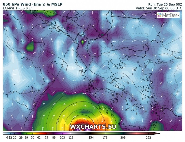
Both global and high resolution models are now in very good agreement in potentially intense warm core cyclone – a Medicane – in the Ionian sea this Friday. In our latest update on this tropical-like system development in the southern Mediterranean, we have noted GFS and ICON-EU models hinting a such development. Today, also ARPEGE, WRF and including global model ECMWF are simulating formation of a Medicane on Sept 28th. Trends reveal the Medicane would rotate in the Ionian sea for 3 days before making landfall in SW Greece on early Sunday. It could bring dangerous extremely severe winds, high waves and torrential rainfall with flash floods threat locally.
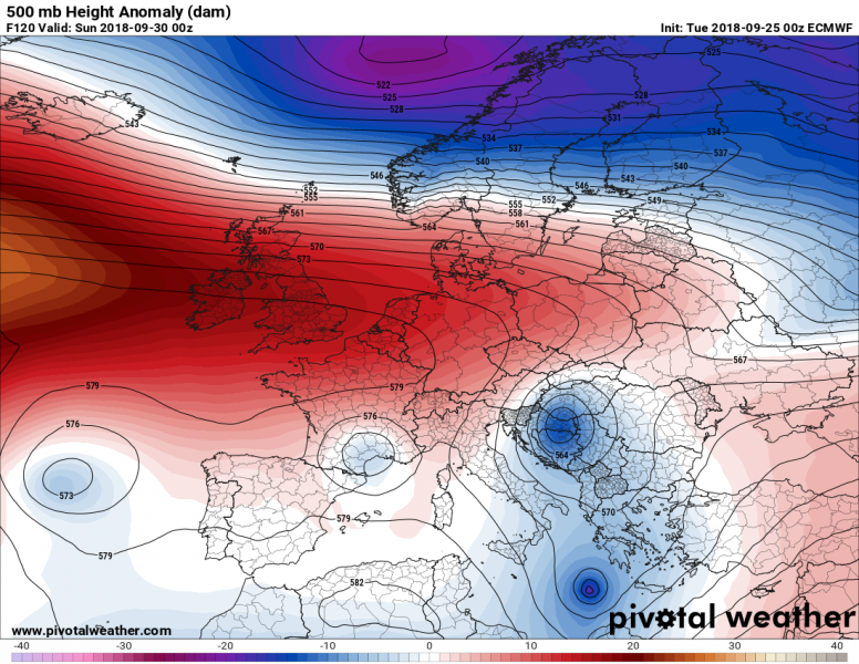
The pattern across Europe is characterized by blocking ridge and stable weather across the western half, while the eastern half remains in quite a dynamic state after a major Arctic outbreak this week. The position of the ridge and low geopotential heights across SE Europe will allow cold advection also into the southern Mediterranean. This will favour the development of a secondary cyclone there. Here is the ECMWF model guidance for Sat/Sun night which clearly hints at the development of a deep cyclone in the Ionain sea.
Map: Pivotalweather.com.
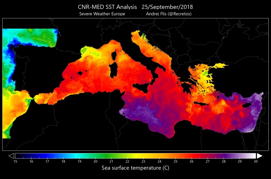
The southern Mediterranean sea remains very warm for this early autumn, almost 2-3 °C above normal as sea surface temperatures are still around 28 °C. Also notice also the anomalously warm seas of the Liguria and Adriatic – however, this will change in the coming days due to a strong downslope Bora winds resulting in significant upwelling effect.
All maps above by our co-admin Andrej Flis.
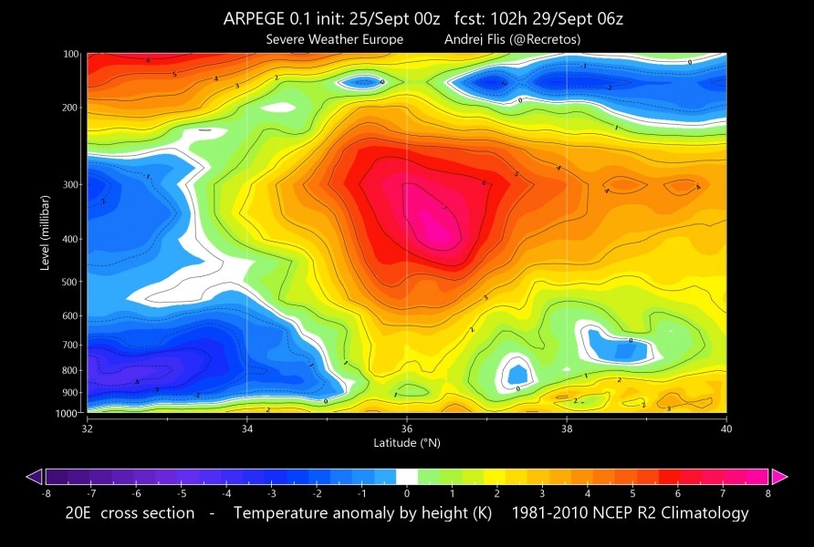
It is very interesting to see a global model hinting a potential warm core development, especially so many days in advance. This is the 850 mbar temperature chart, it reveals a very warm (up to +16 °C) centre of the cyclone against the much cooler surrounding airmass. The bottom ARPEGE model graphics are showing the cross-section of temperature anomaly through the lowest 100 mb and 500 mb temperature chart – a solid warm core system with very warm airmass in mid to upper levels!
Map: Meteociel.fr.
Maps above by our co-admin Andrej Flis. Input data by Meteo France.
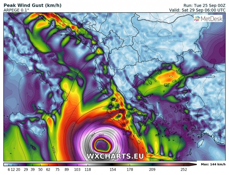
10 m peak wind gusts on Saturday morning, Sept 29th. A pretty impressive large wind field of the cyclone, peak gusts up to 144 km/h across the SW quadrant.
Map above by our co-admin Andrej Flis. Input data by Meteo France.
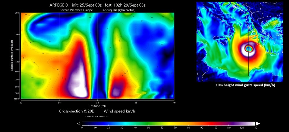
Here is a cross section (from south to north) of the maximum sustained 10 m winds on Saturday morning, 06 UTC across the centre of the Medicane. An impressive wind field packing 141 km/h sustained (!!) winds – a solid Category 1 strength on the Saffir-Simpson scale (for hurricanes)! Peak gusts are shown on the graphic on the right.
Map above by our co-admin Andrej Flis. Input data by Meteo France.
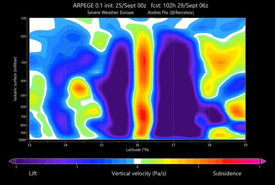
Cross section of the vertical velocity – the rising motion across the deep convection within the intense eyewall-like structure. Subsidence/sinking air is present in the centre/eye of the cyclone. Typical tropical-like behaviour.
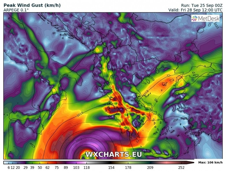
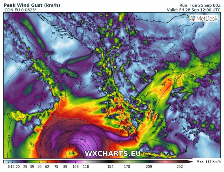
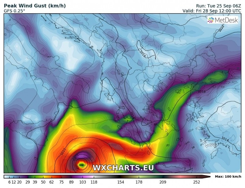
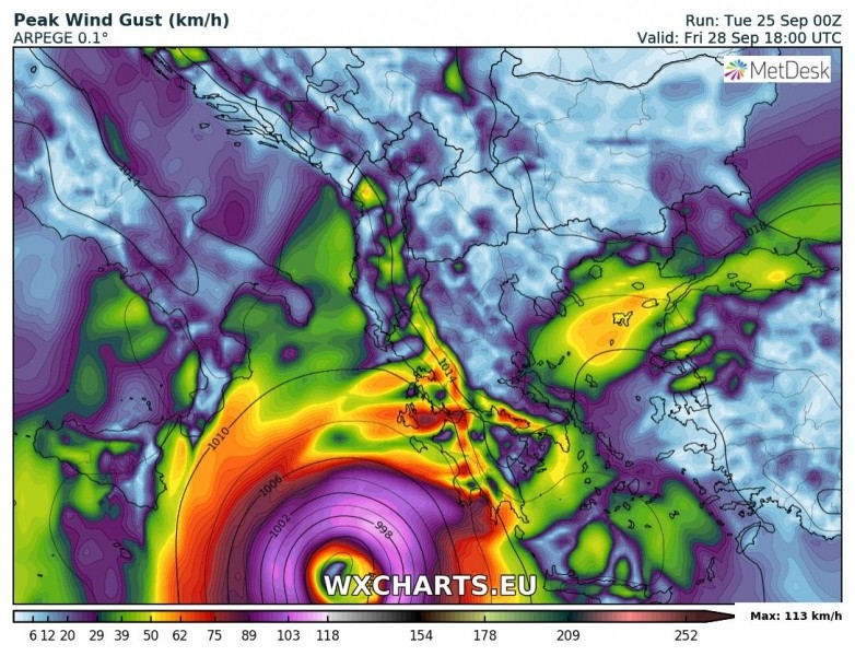
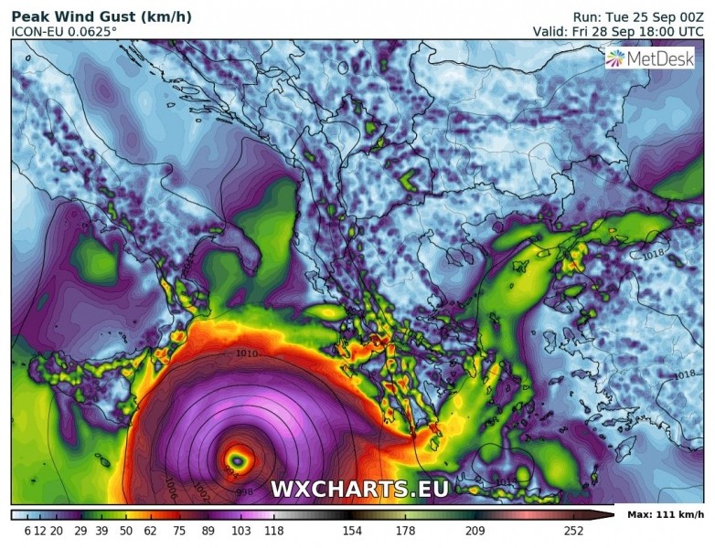
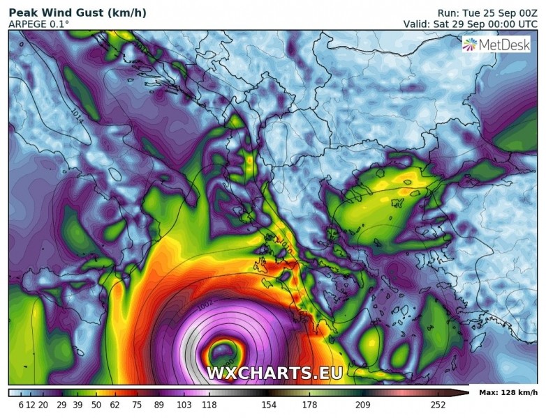
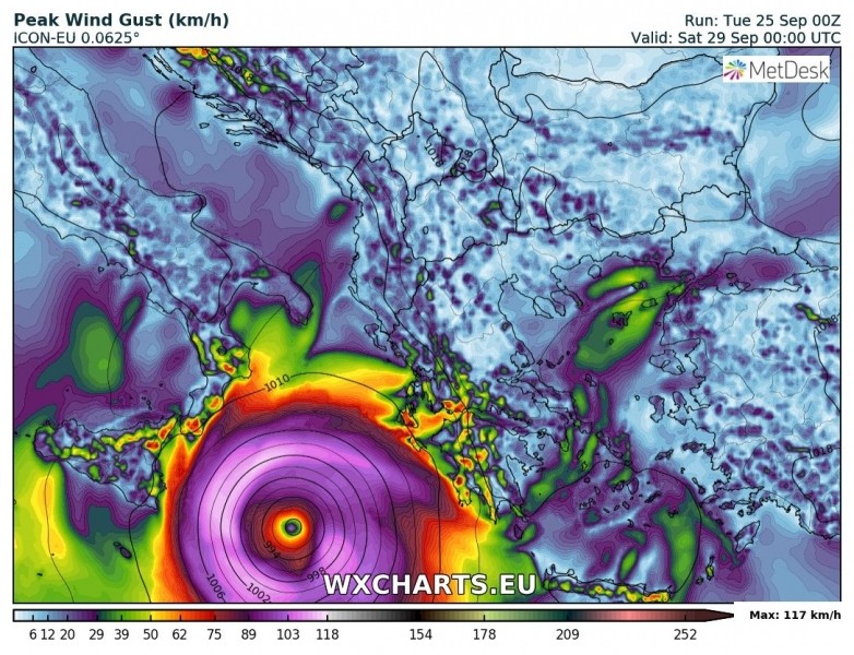
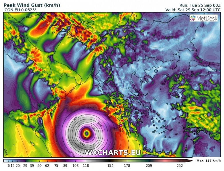
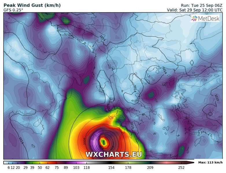
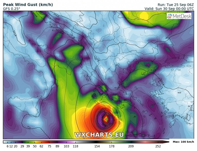
Let us get into more details on the evolution of Medicane this weekend. Most models are in agreement on the cyclone formation by early Friday somewhere in the southern part of Ionian sea and then gradually moving north/northwest by Saturday before turning east towards Greece. Attached are high-resolution ARPEGE and ICON-EU models, including global models GFS and ECMWF graphics. Agreement on the Medicane development is quite good!
Friday 12 UTC
Friday 18 UTC
Saturday, 00 UTC
Saturday, 06 UTC
Saturday, 12 UTC
Saturday, 18 UTC
Sunday, 00 UTC
Based on the latest model guidance, the Medicane will likely be turning sharp east on the late Saturday, nearing SW Greece for a landfall on Sunday, Sept 30th. Both GFS/ECMWF models and ARPEGE models agree on this scenario, despite the still many uncertainties that exist.








Δεν υπάρχουν σχόλια:
Δημοσίευση σχολίου